


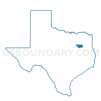
Voting District 004F, Henderson County, Texas
About
Outline

Summary
| Unique Area Identifier | 674628 |
| Name | Voting District 004F |
| County | Henderson County |
| State | Texas |
| Area (square miles) | 11.99 |
| Land Area (square miles) | 11.99 |
| Water Area (square miles) | 0.00 |
| % of Land Area | 100.00 |
| % of Water Area | 0.00 |
| Latitude of the Internal Point | 32.13444030 |
| Longtitude of the Internal Point | -95.54884270 |
Maps


Graphs
Select a template below for downloading or customizing gragh for Voting District 004F, Henderson County, Texas


Neighbors
Neighoring Voting District (by Name) Neighboring Voting District on the Map
- Voting District 004P, Henderson County, TX
- Voting District 04CC, Henderson County, TX
- Voting District 04MS, Henderson County, TX
- Voting District 04NY, Henderson County, TX
Top 10 Neighboring County Subdivision (by Population) Neighboring County Subdivision on the Map
Top 10 Neighboring Place (by Population) Neighboring Place on the Map
Top 10 Neighboring Unified School District (by Population) Neighboring Unified School District on the Map
- Brownsboro Independent School District, TX (15,836)
- Frankston Independent School District, TX (4,514)
- Lapoynor Independent School District, TX (2,613)